Wednesday, December 1, 2010

The National Road / Route 40 - from the French and Indian War to Frank Lloyd Wright - Over 250 Years of Must See History

The Old National Road - From Cumberland Maryland to Brownsville Pennsylvania.

For any enthusiast of US Colonial History, Westward Exanpansion, once thriving industrial towns and blue highways, route 40 (the Old National Road / National Pike), is a must do adventure. While the ground I'm discussing here is accessible from DC for a day trip, you'd have to do what I did in the day chronicheled here at a pretty fast pace.  I recommend a few lodging locations in this entry, as you'll find plenty to do spending at least one night in Western Maryland/South West Pennsylvania. I've picked this portion for it's mountain beauty, historical signifigance and it's many remenants from it's bygone days as the nations first transportation artery.

As I have my roots in Ohio - my parents live in Toledo, friends in Columbus, Cincinatti etc., I've always sought out the scenic back ways to reach Buckeye State destinations and what better method than the former National Pike/Road now present day US 40, which stretches from Delaward to California but which has some of the most beautiful and historic portions within hours of Washington. I used to be a purist about taking this road, i.e. I would pick it up in Frederick Maryland (the closest the road comes to DC) and follow it continually West. The drawback for this is the time involved. Passing through periodic small towns with 25 mph speed limits means adding a few hours onto any trip. I've always been intrigued by this stretch of the    road.  My father took the family on this portion of rte 40 on our first family road trip to Washington when I was about 14 years old.

What's we'll see in this overview is an area rich in history - from famous battle sites in the French and Indian Wars, where a young Leuteniant George Washington earned the respect of those he served under, to what many consider the most beautiful bridge in Ameria (don't forget I have a bridge obsession), also the oldest cast iron bridge in America, famous roadside landmarks, The Summit Inn, just east of Uniontown, PA, and my real favorite aspect -abandoned and/or refurbished period roadside architechture (gas stations, old motels, diners).


Flatiron Building Brownsville and 40 bridge behind
I was meeting a friend from Columbus Ohio and we had to figure out a good half way point to rendez-vous. I had recently passed through Brownsville Pa., on the way back from Ohio.  The town once played a pivotal in role in American westward expansion - once early settlers reached the town they could get on a flat boat in the Monogahela River and travel all the way to the Ohio Country via the Ohio river.  It now sits in mute testament to the nations past industrial prowess, a combination ghost town and symbol of new found historical pride and preservation.  Visit this town before it's filled with pourpourri shops and year round Christmas item stores, which at present economic growth rates might not be achieved for awhile, but it will. I wanted to share it with my friend and see again the sites in town I wanted to savor again, minus my 8 year old who at the time was anxious to return to DC.  We'll get back soon, but first the trip must begin....


Cumberland Maryland from the alt. 40 / 68 overpass
 The drive from the metro DC area to Brownsville should take about 4 hours but I had to drop in on some of my favorite touchstones along the way. I took 270 to route 68 west (Hancock, MD) and arrived in Cumberland just over two hours out of DC.  For those who have never paid a visit to Maryland's western capital, you can make a day or two leisurly exploring this charming city.

I was passing over the bridge pictured to the right and could see steam billowing near the train station. The Western Maryland Steam Engine excursion was ready to leave the station.  I had my video camera in tow, and I was presented with a great chance to capture a noteworthy rail fan video. Problem was I needed to get a view of the engine coming at me down the rails (this would be so much more interesting that what the excursion riders themselves will see I smugly thought to myself).  I flew through the old back streets of town until I came across the tracks (think Steve McQueen in Bullitt) - I had arrived in time, or so I thought....I was poised with camera at side of the rails ready to shoot but I could hear the train whistle getting further away (not a good sign).  I approched a local sitting idly in his truck and queried after the train - "uh, sorry but you got the wrong set of tracks here son"....As I headed out of town, any sense of self worth shattered, I gave a nod to George Washington's Headquarters, when Ft. Cumberland was a real frontier town.

Washington plays a big role in this article and this town is really where Washington began his meteoric climb onto the global stage. The one room cabin, used by George Washington as a young aide to General Braddock, was built in 1754-55 and is the only remaining structure of Ft. Cumberland. Cumberland was the furthest western outpost in Colonial America and as Britain and the Colonists looked Westward there was a clash waiting to happen.  Someone else was in these wooded mountains besides the Native American tribes....

Grantsville Maryland - Casselman River Bridge
I jumped back onto 68, and made more some time up, (picking up 40 in Cumberland is rewarding but slow going), I continued on to Grantsville Maryland and joined 40 again. I can never pass up what I consider the most pleasing bridge in the entire country, the Casselman River Bridge. It's blending of materials (native limestone), soaring arch and mountain mountain setting make this site the perfect spot for a picnic.  It was one of the first major bridges on the National Road and at 354 feet, was the longest single-span stone arch in the United States when built. Skeptics were sure it would collapse when the supports were removed, but the 80-foot-long arch proved equal to the tidal wave of stagecoaches and cargo wagons that poured over it, carrying goods and people from Cumberland to the western frontier. Today the National Historic Landmark bridge is a pedestrian crossing in a state park. From the bridge one can see the march of progress: a 1930s metal truss on US 40, which supplanted the 1813 stone arch, and a modern steel-beam bridge, which carries IS 68 and the bulk of traffic in far western Maryland.


Atop Casselman River Bridge - 40 and 68 stand in the fore and distance

Grantsville, 1/2 mile west of the Casselman River, began as a small Amish and Mennonite settlement, called Tomlinson's or Little Crossing, along Braddock rd., which wound westward from Cumberland over Negro Mountain. Later a new village flourished as a stop along the nearby National Road. From 1818, the national road carried hundreds of thousands of pioneers and settlers in stagecoaches and covered wagons.  The Casselman BridgeSigns mark the location of the post office and the blacksmith shop that stayed open all night to fix broken horseshoes. An 1879 article in Harper's Monthly described the wagons as "so numerous that the leaders of one team had their noses in the trough at the end of the next wagon ahead."

Near the Casselman Bridge, is the Penn Alps Restaurant and The Spruce Forest Artisan Village. Penn Alps Restaurant is housed in the last log hospitality house on the National Pike. It is situated between a 1797 gristmill and the Casselman Bridge.

Spruce Forest Artisan Village, a part of the extended Penn Alps campus, has grown from a few cabins to some 12 log and frame structures of early vintage, two of which date to the Revolutionary War Period. Most of these provide studio space for artisans. Artisans work in various media, including: bird carving, stained glass, basket making, hand-loom weaving, and hand-thrown pottery.

General Braddocks Grave Site


Live in the DC region long enough and one notices how often this name comes up, Braddock Rd. in Alexandria for example, but many probably don't know General Braddock was an English General sent with some 2,000 redcoats and native militia to confront the French at Fort Fort Duquesne, present day Pittsburgh. The route I was on started out as a road built by the Army on it's march west, from Alexandria Virginia to an area just outside Pittsburgh where the army was routed by a combined French and Indian force. General Braddock was mortally wounded during the fighting and George Washington accompanied him from the battlefied. As Braddock was carried from the field severely wounded, the surviving British fled. British losses were staggering: more than 900 killed or wounded out of 1,400 men engaged. They were completely beaten by a force they could not see in a wilderness where they did not want to be.  Washington reported "The shocking Scenes which presented themselves in this Nights March are not to be described. The dead, the dying, the groans, lamentations, and crys ... of the wounded for help were enough to pierce a heart"

On July 13 The British camped about one mile west of the Great Meadows, site of Fort Necessity , and in the evening Braddock died. Washington officiated at the ceremony the next day. The general was buried in the road his men had built. The army then marched over the grave to obliterate any traces of it and continued to eastern Pennsylvania. It wasn't until much later, while the national road was being built that his grave was discovered. When you pull off 40 into the small park you follow a trace of Braddocks road that remains here and see where his body was hidden. A large memorial marker now stands where the general was re-intered.  I've always been facinated by this marker and can't resist it's allure (the fact that it's literally on Rte. 40 makes pulling off that much easier).

Passing through Uniontown Pa.


A glance at my watch and a semi anxious call from my buddy Chris (he was approaching Brownsville now) and I was still about 40 minutes away by my calculations.  I was now coming down the mountain and headed towards Uniontown Pa.  This town was another early beneficiary of the Old National Road and took a renewed pride in it's place in history.  Drive old 40 through downtown and you'll be treated to a treasure trove of roadside Americana - from solid stone inns from the 19th Century to grand neon from the golden age of road travel.  In the interest of time, I decided I'd better take the bypass around town.  This turned to folly on my part - the road was under construction and I missed my turn off to get back on 40.  While making an exit to get back on course I was greeted by a legendary figure in roadside Americana lore - I had stumbled upon one of the legendary "Muffler Men".   Muffler Man (or Muffler Men) is a term used to describe large molded fiberglass sculptures that are placed as advertising icons, roadside attractions or for decorative purposes. Standing approximately 20 feet tall, the first figure was a Paul Bunyan character designed to hold his axe.  Derivatives of that figure were widely used to hold full-sized car mufflers, tires, or other items promoting various roadside businesses.  I had seen many of these in books but hadn't seen one in person - the sense of pride of discovery once again enveloped me!

Explore this topic further at Roadside America.com.

Brownsville PA

I finally arrived in Brownville around 1:30 p.m. and met up with my friend Chris - actually I saw him in the street and I gunned the engine in a mock attempt at running him over as while he pretented to unload a spray of lead in my direction (no, we haven't fully grown up).  We spent some time down at a small park on the Monogohela river and gazed over the bend in the river that made for the best crossing point and natural water access point long before the town was ever settled.  In a real sense, this marked the end of the road for many early pioneers as here they were able to board a steam boat and head into the wilds of Ohio and Kentucky.  We walked up to the end of Market Street where I showed Chris a bridge, small in stature but that ranks with the Eiffel Towner in terms of engineering historical signifigance. Dunlap's Creek Bridge was built in 1839 and carried old U.S. Route 40 over Dunlap Creek which drains into the Monogahela in the midst of downtown.  It is the nation's oldest cast iron bridge in existence and still carries road traffic.


Just up the road stands the Flatiron Building (c. 1830), constructed as a business building in thriving 19th-century Brownsville, it is one of the oldest, most intact iron commercial structures west of the Allegheny Mountains. It is the unofficial "prototype" for the flatiron buildings seen across the United States. The most notable is the Fuller Building in Market Square in New York City. After nearly being demolished, the building was saved by local preservationists and now serves as an historic asset to Brownsville. The Flatiron Building Heritage Center, located within the building at 69 Market Street, holds artifacts from Brownsville's heyday, as well as displays about the community's important coal and coke heritage. Brownsville is the location of other properties on the National Register of Historic Places, such as Bowman's castle (Nemacolin Castle), the Philander Knox House, and the Brashear House.

I was anxious to visit a site that I had passed numerous times in the past, Jumonville Glenn.  This site held all the answers as to how the English (and Colonists) came to war with France and her allied Indians, and at the center of this was a young George Washington who set off this entire conflagaration.   I wondered why I didn't know more about this spot - turns out there's pretty good reason - George Washington's conduct during this clash - between his scouting force and that of the French would have would have had Washington in front of a UN court had it happened today.
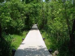
Jumonville Glen -


Jumonville Glen - present appearance and painting of the ambush.


The account varies widely as to what exactly took place here, what is known is that the British colonial force had been sent to protect a fort under construction under the auspices of the Ohio Company at the location of present-day Pittsburgh, Pennsylvania. A larger French force had driven off the small construction crew, and sent Jumonville to warn Washington about encroaching on French-claimed territory. Washington was alerted to Jumonville's presence by Tanacharison/ Half King (an allied Seneca Indian Chief - the various Indian alliances between continental forces is too complex to describe here). Tanacharison informed Washington that a party of French soldiers was camped in a ravine not far from his position at Great Meadows. On the stormy night of May 27th, 1754, Washington and about 40 men began an all night march to confront the French and learn their intentions. They travelled through woods so dark the men sometimes spent nearly half an hour just trying to find the trail.  Washington and his men easily surrounded the unsuspecting French as they hadn't posted sentries.


A shot was fired, no one really knows by whom, and soon the peaceful glen was filled with the crash of musketry and the sulphurous smell of powder. The skirmish lasted about 15 minutes. When it was over, 13 Frenchmen were dead and 21 captured. One escaped and made his way back to Fort Duquesne at the forks of the Ohio. Washington's casualties were one man killed and two or three wounded.


Washington treated Jumonville as a prisoner of war and extended him the customary courtesies due a captured military officer. Washington attempted to interrogate Jumonville but the language barrier made communication difficult. During their conversation however, the Half King walked up to Jumonville and without warning struck him in the head with a tomahawk, killing him.

Why the Half King did this has never been clear. He had been kidnapped by the French and sold into slavery as a child. He claimed that the French had boiled and eaten his father. He was also a representative of the Iroquois Confederacy, which stood to lose its authority over other Indian peoples in the Ohio River Valley if the French were able to assert their control. (For a detailed discussion, see Fred Anderson, Crucible of War: The Seven Years' War and the Fate of Empire in British North America 1754-1766 (2001).)

When word reached Fort Duquesne about the incident, Jumonville's half brother, Captain Coulon de Villiers, vowed revenge. He attacked Washington and the garrison at Fort Necessity and forced them to surrender on July 3, 1754. In the surrender document, written in French, Coulon de Villiers inserted a clause describing Jumonville's death as an "assassination". Washington, who did not speak French, signed the document. The assassination of the French diplomat and revered soldier Jumonville would later be used as propaganda by the French against the war crimes of Washington and the British, during the conflict.

Washington was heavily criticized in Britain for the incident. British statesman Horace Walpole referred to the controversy surrounding Jumonville's death as the "Jumonville Affair" and described it as "a volley fired by a young Virginian in the backwoods of America [that] set the world on fire."

The Glenn today really is off the beaten path, just a few miles off route 40, the visitor is served by a modest parking lot and a haunting hike to the rock formations that butressed the French campsite.  After we tramped through the Glenn to our content - Here I have to mention I somehow led us off the main trail, deep into adjacent woodland where we emergered onto a road a few miles from our car.  This walk was great in its own right, large portions of Braddocks original road remained and shadowed our progress.  When we finally got back to the cars, we were pretty famished and daylight was fading - our plan to visit Fort Necessity wouldn't happen this trip.  This is where the French exacted revenge of sorts and George Washington made his first and last surrender July 4, 1754.  


The Summitt Inn Hotel


We were coming out of the now lingering dusk and were at the foot of one my favorite landmarks along this route, the historic Summit Inn.  I had passed it many times but had never stopped to appreciate the architecture and views up close.  It boasts a grand porch and pool which overlooks the twinkling lights of Uniontown at the base of the mountain.  After a hearty meal and a beer it was time to part with Chris and head back to DC.  I will return to these sites and others, such as the nearby Frank Lloyd Wright masterpiece, Fallingwater....


Photo Gallery - Great site - focus here is Fayette County, PA

http://www.cumberlandroadproject.com/index.php

on Facebook -

http://www.facebook.com/pages/The-Cumberland-Road-Project/198355806673?ref=search&sid=100000531763470.2474972767..1

http://en.wikipedia.org/wiki/Battle_of_the_Great_Meadows

National Park Service - http://www.nps.gov/fone/planyourvisit/

Other Areas in interest in Fayette County Pa -

http://www.mstand.com/articles/?v=recent_additions&%3Bview=summary&view=detailed&page=404

Places to stay -

http://www.nationaltrailmotel.net/Attractions.htm

Tuesday, October 19, 2010

Rock Creek Park, Teddy Roosevelt Side Trail - Pulpit Rock and Boulder Bridge

Rock Creek Park when taken as a whole certainly warrants no consideration under the "off the beaten path" moniker.  In fact areas of it can be subject to swarms of people - think National Zoo on a pleasant Sunday afternoon.  But certain trails - the very best ones in fact are seldom used.   I've covered a lot of them but my favorite has to be the Teddy Roosevelt side trail.  The views along this portion of the park are among Washington’s best-kept secrets, seldom appreciated by tourists.


When I take this trail I'm always reminded of President Roosevelt and his frequent outings to the Park. When he first became president he was a vigorous 42 year old, an advocate of "the strenuous life" fond of chopping down trees on the outskirts of Washington and swimming across the Potomac. The press had a field day covering his athletic outings. Roosevelt was particularly fond of what he called "scrambles," exhausting cross-country hikes. His favorite place in Washington for these expeditions was Rock Creek Park, where he led members of his "Tennis Cabinet" and various hapless foreign diplomats on grueling hikes. His motto was "Over, Under or Through – But Never Around."


My favorite story involved the French Ambassador Msr. Jusserand, who like Roosevelt was an avid birdwatcher. The natty Jusserand gamely followed T.R. on many excursions, writing of one occasion when they forded a creek, "I, too, for the honor of France removed my apparel, everything except my lavender kid gloves. The President cast an inquiring look at this as if they, too, must come off, but I quickly forestalled any remark by saying, ‘With your permission, Mr. President, I will keep these on; otherwise it would be embarrassing if we should meet ladies.’"


To get the trail head, head north on Beach Drive until it merges with Broad Branch Road, take an immediate left and park in the lot which accommodates about 20 cars (about 100 yards due north of Pierce Mill).  Exit the lot, take a right, cross over the bridge on Beach Drive and bear left - you'll see the sign for the Teddy Roosevelt trail here.  The trail ascends slowly but steadily and has some precarious footing but it gets interesting as you rise above Beach Drive - mercifully closed to traffic on weekends.  At about a quarter mile you'll reach the top of Pulpit Rock.  Take a moment here to appreciate the view and solitude.  If you scramble down to the flat boulders adjacent the jutting pulpit, you'll find a perfectly secluded perch.  It was obviously a favorite spot of the Blagden family - the boys of which carved their names in the stone around 150 years ago when the mill was active and the family lived on site.   The Blagden Mill was directly across the creek from Pulpit Rock in the 19th Century.  When you decide to move on, you can explore the ridge a bit which is covered in mountain laurel or descend back down towards the creek heading north. The descent is quick and soon you'll be on the east bank of the creek scrambling over rather rough rocky terrain.  Continue around the bend and you'll see Boulder Bridge.  This historic bridge is one of the most important in Washington for a number of reasons.  Boulder Bridge was constructed in 1902 and carries Beach Drive across Rock Creek.  The reinforced concrete arch bridge was designed by architect W. J. Douglas and was built at a cost of $17,636.  The real story here was the man who made this sort of architectural folly possible - Josef Melan an Austrian engineer. He is regarded as one of the most important pioneers of reinforced concrete bridge-building at the end of the 19th century and is credited as the inventor of the Melan System, a method for the construction of reinforced bridges.  This system was unique  because Melan did not build iron bars into the reinforced concrete bridge structure, but used rigid truss arches made of iron.  At this point you can continue north on the Valley Trail or swing left and head back to the parking via the Western Ridge trail.
Other areas of note in Rock Creek -

•Bridge Architecture: Even a casual observer is awed by the massive concrete bridges crossing Rock Creek. The Connectict Avenue bridge is the largest and the Dunbarton the most elegant, with it's elegant curves and terra cotta indian heads adorning the sides.

•19th Century History: Pierce Mill is the featured attraction

Getting to Rock Creek - The following take the visitor to the Nature Center which is great starting point for a wider variety of trails - all of which offer seculsion in the bustling metropolis.

Take Route 66 across the Teddy Roosevelt Bridge. Get in the right lane on the bridge, and take the ramp for Independence Avenue. Turn right at the bottom of the ramp (heading towards the Kennedy Center along the river; this is Ohio Drive, but it's not marked as such). After passing the Kennedy Center (under its terrace) and Watergate, continue straight onto Rock Creek Parkway. When the parkway ends (near Connecticut and Calvert), continue north on Beach Drive. You will pass the zoo and Pierce Mill. Continue on Beach Drive until you see a sign for the Nature Center; bear left here (onto Glover Road), as the sign instructs. (*On weekends there will be a gate across Beach Drive, so you will be unable to go to the right!) Follow the signs to the Nature Center. Via the Beltway or Maryland: Take the Beltway north into Maryland; exit at Connecticut Ave. and proceed southbound toward Chevy Chase. About 7-8 blocks south of Chevy Chase Circle, turn left onto Military Road. Go a little over a mile, and you will see a big brown sign that says "ROCK CREEK PARK-NATURE CENTER..."etc. Take the next right (at the traffic light), as the sign instructs, and follow subsequent signs to the Nature Center.

Via the Chain Bridge (VA):

At the end of the bridge, turn right onto Canal Road. Make the first left (at the light) onto Arizona Avenue. Proceed on Arizona until you come to a "T" intersection; make a right turn there onto Nebraska Ave. (The signs there may say "Loughboro Rd.," but it runs into Nebraska.) Proceed on Nebraska past American University, around Ward Circle, and across Wisconsin and Connecticut Avenues. Get into the right lane and turn right onto Military Road; less than 1/2 mile after you cross Connecticut. After a little less than a mile, you will see a big brown sign that says "ROCK CREEK PARK-NATURE CENTER..."etc. Take the next right (at the traffic light), as the sign instructs, and follow subsequent signs to the Nature Center.

From Dupont Circle:

Proceed Northeast on New Hampshire Avenue for approximately half a mile when it will intersect 16th Street. Head north on 16th Street, towards the Maryland border. About 3 1/4 miles up the road, it will intersect Military Road, after Madison and Nicholson Streets. Take the right hand exit onto Military Road west (cloverleaf ramp). Cross Military Bridge and then it will turn into a small parkway. Get in the left-hand lane. Make a left at the first light that you come to, at Glover and Oregon Roads. You are now on Glover Road and can follow the signs to the Nature Center.

Public Transportation:

The Friendship Heights or Fort Totton Metro are the closest to the Nature Center. Take the E-2, E-3 bus (from either Metro stop) to the intersection of Glover & Military Rd. Get off, look to your left and follow the trail up to the Nature Center. The Van Ness Station is the closest metro stop to Peirce Mill, but it is still about a mile away. From Van Ness, walk south on Connecticut Avenue to Tilden Street and make a left. Follow Tilden to the bottom of the hill and the mill is on your left. Foggy Bottom is the closest metro stop to the Old Stone House, from there walk north to Washington Circle and take Pennsylvania Ave. west M street and continue west along M Street to the Old Stone House, about a 1/2 mile.

http://www.nps.gov/rocr/

Pulpit Rock is located at latitude - longitude coordinates (also called lat - long coordinates or GPS coordinates) of N 38.945111 and W -77.046644.

Wednesday, September 29, 2010

Roosevelt Island - A Green Gem In Middle of DC


Whether your a resident of Washington DC or an intrepid visitor, Roosevelt Island is small in scale but full of pleasant surprises.  Not only will you find solace from the harried pace of life in Washington, you'll see a surprisingly mixture of topography, flora and fauna and get to see an interesting monument which celebrates the nation's first environmentally conscious president.  While the statue itself looks a bit like Vladimir Lenin giving a rousing speech, the architectural elements are pleasing.  There are two fountains and four 21-foot granite tablets inscribed with quotes that capture Roosevelt’s conservation ideals.

I work in Rosslyn Va., and this island is just the place when I want to go for a walk and gather my thoughts. Most people don't venture onto the island because getting there is not easy (see specific directions below).  The only access point is a footbridge that's accessible from the Virginia side, right off the GW Parkway.  As you cross the bridge, you'll note the great view of Georgetown University and the Key Bridge off to the left.  Head straight on the trail into the center of the island to visit the monument itself then veer to the right and get on the swamp trail.  This trail can be covered easily in about 30 minutes and will take you a tidal swamp where you're bound to see Great Blue Heron, Red Wing Blackbirds and Carolina Wrens.  The trail will take you on a loop that is mostly made up of easy on the feet boardwalk.

Theodore Roosevelt Island is accessible only from the northbound lanes of the George Washington Memorial Parkway. The entrance to the parking lot is located just north of the Roosevelt Bridge. Parking spaces are limited and fill quickly on weekends. By metro, go to the Rosslyn station, walk 2 blocks to Rosslyn Circle and cross the pedestrian bridge to the island. See a Map

Also, the island is located right along the Mount Vernon Trail and is easily accessible by bike. Bicycles are not permitted on the island but there are racks in the parking lot to lock them up.
A fun alternative way to reach the island is to rent a canoe or kayak from Bill's Boat Rentals which is found almost literally under the Key Bridge in Georgetown.  Fees are nominal and you can imagine yourself as an early colonial era explorer - OK, that takes a lot of imagining, especially with the jets that roar overhead on their landing approach to Reagan National Airport but you'll enjoy this method, rest assured.

Theodore Roosevelt Island is accessible only from the northbound lanes of the George Washington Memorial Parkway. The entrance to the parking lot is located just north of the Roosevelt Bridge.


Southbound traffic: take Theodore Roosevelt Bridge to Constitution Ave. Take a right on 23rd St. and cross Memorial Bridge. Once on the bridge, bear right to return to the G.W. Parkway.


The closest Metro Station is Rosslyn on the Blue and Orange Line.

Theodore Roosevelt Island
Visitor Information
(703) 289-2500


Friday, September 17, 2010

Strausburg Pa - Steam Engines in Amish Country

My four year old has the Thomas Train bug and while he's done a lot of rail fan activities with dad, he'd never seen a working steam locomotive. It was time to change that. Labour Day weekend rolled up on me, and being a notorious last minute planner, I had acted too late. No Deep Creek Lake, No Cumberland Md. train ride, No Mountain Cabins - seemed the world was booked.

I have been to York Pa., and Lancaster, the largest city in Amish Country, and one of the first cities founded inland from the Atlantic seaboard, on numerous occasions but never made it into the actual heartland of Dutch Country Pa. which is located in Lancaster County.  This really is the, center of Amish life and a home to a world famous working steam railroad found in Strasburg (about 5 miles outside of Lancaster itself).  Lets not forget all the must see hamlets in the sourrounding country with the interesting, if not oft made fun of names such as Bird in Hand and of course Intercourse - tee hee.

I realized that Strasbourg Pennsylvania would be a great destination and rooms would be available in and around Lancaster. The convenient thing about this rail town is the fact they have trains running every hour from about 11am until 7pm.  The train yard was such a cheerful site - I was as excited as my little man. The town includes the Railroad Museum of Pennsylvania, a museum of toy trains, a working train layout (the Choo Choo Barn) - it surpassed all expectations.


I knew the region was easily accessible via 95 N. to Baltimore, 83 up to York Pa, then 30 East to Lancaster - Strasburg lies just few miles beyond.  Opting for a different route, I decided on Rte. 95 to Baltimore until I crossed the Susquehana River and took the road through Port Deposit Maryland. The payoff was huge.  Port Deposit is similar to old Ellicott City, only instead of being nestled in an valley, this town was built on the narrow strech of flat land between the river shore and steep rocky cliffs.  The town boast a variety of fine dining (think seafood) and enough great early 19th Century Architecture to make this town stop a must.  Seems the bikers like this destination too - I noticed a lot roll through town, their periodic rumblings made more tolerable by the beauty of the day and surroundings.

We pulled into Strasburg just in time for the train - the stress of that near miss quickly evaporated as the train pulled out, the whistle blew and the steam bellowed - we were off and rolling through the tidest assortment of farms I've ever seen, it really was reminecient of the pages from a 1950s children's book.  The Amish waited patiently in their buggys as train snaked through rolling terrain.   The only criticism I had was the duration - I could have ridden for hours but twilight was coming and we didn't have lodging, so it worked out.  Our first choice was the Red Caboose Motel. There were about 50 vintages train cabooses painted out in the regalia of many long gone train lines, but of course it was booked up.  It wasn't long until we came across a vintage motel, picture perfect 1950's with a resplendent neon sign out front - the Dutch Treat Motel.

The following day, we drove around the countryside, paid a visit to the Intercourse Cannery for some fresh applebutter then hit the Choo Choo Barn.  This massive train layout has a reasonable admission rate and the anatromic diarama was first rate, my son was going bananas.  After the obligatory trip to the gift shop, we headed for the Dutch Haven.  This was a personal highlight of the day for me -seeing the first roadside attraction that went up in Amish Country in the 1940s. It was and remains the best site to purchase the Amish favorite - the famous Shoo-Fly Pie.  I love goofy architecture too and this building fit the bill - a large windmill mounted on an octangular shaped building.

We drove back into Lancaster and paid a visit to Franklin & Marshall College which was established in 1787 with a gift of 200 British pounds from Benjamin Franklin. This private college boasts my favorite piece of architecture.  Built in 1853 F&Ms main building is called "Recitation Hall." The distinctive, tall-towered structure, designed in the Gothic Revival style, was constructed on "Gallows Hill," the former site of Lancaster's public executions and the highest point of ground in the city. At the laying of the building's cornerstone in 1853, Henry Harbaugh, a Marshall College graduate and pastor of the Reformed Church of Lancaster noted that the city's lowest point was the location of the Lancaster County Prison. Harbaugh stated: "Thank God! The College stands higher than the jail. Education should be lifted up and let crime sink to the lowest depths!" Recitation Hall came to be known as Old Main and the ground as College Hill.  The distinctive towers of Old Main is now undergoing renovations, much of it dismanteled and sheathed in scaffolding (ugh).  We drove onto York, then South to Baltimore.  We arrived home all in about two hours.  I can't wait to go back - we'll be repeat visitors...

Monday, September 13, 2010

Neon Nights - Route 1 between DC and Laurel

As a long time fan of roadside architecture and especially the road side signage that still exists in some abundance I'll catalogue some regional gems. To effectively find it lost in the urban sprawl and gentrification of the DC metro area the conniseur will best be rewarded by traveling the, what are now secondary highways, the older routes which existed prior to the interstate system.  Route 1 of course boasts the entire eastern seaboard and allows one to drive its full length from Maine to Florida if you don't 763,746 traffic lights along the way.  Of course now the route is replaced by Route 95 which is great in coveying travelers rapidly but offers little in the way of commercial eye candy.

Living in Takoma Park MD, I'm in close proximity to the stretch of road that goes through Hyttsville, College Park, Beltsville and Laurel MD.  In fact the following gems are some of my favorites.  Headed North from DC, the first stop has to be the recenlty revived Hyattsville.  I love the plethora of 40s and 50s architecture, from Lustines automotive neon sign (now thankfully saved as part of a gym), to the crumbling gas stations with their stylized lines and old advertising.  The first honey of a sign belongs to Vet's Liquors which is found in Beltsville on the left hand side.  This looks to me like post WWII era and the novelty of it is first rate, just enough mix between industrial and folk art.  I have to say, I've never seen a sign which utilizes light bulbs for eyes.

Next up on my favorite list is the Giant Food sign from the parking Lot in Laurel in which George Wallace was wounded in an assignation attempt while running for President.  The sign is magestic and according to local followers prone to humerous word arrangements when the bulbs go out.

Laurel is also home to an original Arby's giant hat sign - all dancing bulbs and enormous presence, you can't miss these - fast disappering from our landscape.

Monday, September 6, 2010

Port Tobacco - End Of Road -

The name itself conjures up a rough and tumble colonial port which in fact Port Tobacco once was. On a whim (or an excuse for a blog entry) I dropped in my friend's Maury and Deb for their hospitality and local knowledge. If we had bug spray it would have been all the better-


Port Tobacco had been the second largest river port in Maryland—St. Mary’s City was the largest at the start of the Colonial Era. Ships from Europe brought prized goods to the Port and left with the much coveted "evil weed" - tobacco. Over time, due to poor farm planning, or rather over farming, the harbor gradually silted up and the river trade declined. The final blow to Port Tobacco came with the burning of the courthouse in 1892 at which point the county seat was moved to nearby La Plata.


With the lure of the beautiful area homeowners gradually have brought some vibrancy back to the area and historic preservation efforts are strong.  Must see sites include St. Ignatious Chruch - the oldest Catholic parish in the US which commands the high ground overlooking the confluence of the Tobacco and Potomac Rivers - one of the best views in the state I have to add.  The orginal brick court house stands not far from a charming one room school house and tobacco barns dot the rolling landscape.


The most exciting visit for me personally was our trip to Thomas Stone National Historic Site just a few miles from Port Tobacco.  It was here that Thomas Stone had built a prosperous farm before becoming important enough on the polictical scene to be one of the signers of the Declaration of Independence - he literally wrote himself into American history.  We found ourselves alone on 322 acres of revolutionary history. The plantion is was named Haberdeventure by the Stones - a “dwelling place in the winds”. Purchased in 1770 by Thomas Stone, this restored plantation home has been open to the public as a National Historic Site since 1997. I found the out buildings especially pleasing - well kept but dating back to the mid-19th Century, they suited the landscape perfectly.  The house is modest in scale and well proportioned with a generous balcony to oversee the land. The family plot is nearby and seems a spledid resting place, Thomas Stone is buried here as well . The only horror story here was the mosquito's - we all managed to get countless bites, so bring along repellent!


We capped a perfect day with carry out from a local BBQ institution - Johnny Boys Ribs, located at 7540 Crain Hwy, La Plata, MD.  This place is well known locally and even regionally.  Don't let the modest roadside architecture prompt you pass this treat up. You will exprience family type finger licking good Bar B Que.  All of the salads are homemade and they have a secret BBQ receipe that pulls in hungry crowds who patiently que up for this treat.

You can reach Port Tobacco in about an hours time once you pick up Rte 5 right off the Beltway and turn on 301 south in the direction Upper Marlboro and La Plata. Unless you're headed here specifically there's really no reason to pass through because this is the end of the road in Charles County.

This is also the route to take if you're interested in the Assasination Plot of President Lincoln and Booths post assissination escape attempt. If you follow the roads mentioned above you'll pass turn offs for Surrats Tavern, Dr. Mudd's House, not to mention Port Tobacco itself where this nefarious scheme was hatched at a local hotel / inn.


.

Sunday, August 15, 2010

Patuxent Wildlife Research Refuge - Birds, Forests, Wetlands and a Tram

Looking for a weekend day trip with the kids that transports you but you don't have to transport yourself far?Then set the controls for Patuxent Wildlife Research Refuge - just check this sucker on the map - it gobbles a huge amount of acreage.  Whether or not the weather is right get over to this bird paradise soon.  Careful though, the gates close at 4:30 - not cool for the afternoon tourist.


As you may have read in previous entries of mine, I've been chasing the elusive Scarlet Tanager for two years running - might this be my lucky day?

I had both kids in tow and my intention was to walk the grounds (some of the refuge is open, much closed to human intrusion), drop by the best wildlife visitors center (ever) - it makes the one in Rock Creek Park look like a gentleman's study.  They have a great wolf display that my daughter loves and this weekend I was treated to the portion that shows a pack greedily devouring a deer, complete with super ick visuals!

The great news we found out upon arrival was that we were just in time for the 3 p.m. tram ride that takes visitors to portions of the park normally off limits to visitation.  You can be treated to wide array of birds, either on the lake or in the tree canopy.  When I spoke with a naturalist as we waited on the tram I asked about the possibility of spotting my elusive Scarlet Tanager. She gave a wry smile and said, "why we have a trail call Tanager Loop" and she cheerily went on to detail all the places I might see them (my heart was a little green toad of envy!). The Tanager has a bright  orange/reddish plumage, black wings and, outside the Oriole, in my esteem, the most handsome local bird.


The tram ride was honestly a bit disappointing during our time slot in terms of wildlife spotted - sorry, deer at 100 yards don't cut it anymore, but it's been great in the past - lots of beavers, amphibians, birds and various flora.

Post tram ride, we hit the meadowland trails adjacent the visitors center as this has always been the spot for Indigo Buntings, Finches, and other birds that dwell in the canopy but  like the meadow menu.  I was dumbstruck when my quarry passed over head - I was incapable of wielding my camera.  I stood with mouth agape as this good looking bird sailed by....I have to see one stationary to compete and verify this odyssey but I feel blessed just having a fly by....


Established in 1936 by executive order of President Franklin D. Roosevelt, the Patuxent Research Refuge is the Nation's only National Wildlife Refuge established to support wildlife research.
With land surrounding the Patuxent and Little Patuxent Rivers between Washington, D.C. and Baltimore, MD, the Refuge has grown from the original 2,670 acres to its present size of 12,841 acres.  Throughout decades of change, Patuxent's mission of conserving and protecting the nation's wildlife and habitat through research and wildlife management techniques has remained virtually unchanged.


Patuxent Research Refuge is one of over 540 refuges in the National Wildlife Refuge System administered by the U.S. Fish and Wildlife Service. The National Wildlife Refuge System is the world’s largest network of lands and waters dedicated to protecting wildlife and their habitat.


Getting Here - In the heart of the Baltimore - Washington corridor, the National Wildlife Visitor Center is located off of Powder Mill Road, 2 miles east of the Baltimore /Washington Parkway, just south of Laurel, Maryland. map


Find out about upcoming events at Patuxent over email! To subscribe, send a message to patuxent@fws.gov and enter 'subscribe' into the subject field. 
NewClick here to see what is new on our web pages!


I recommend the Tram Tours


Wildlife Conservation Tram Tours
Mid-March through Mid-November

Weekend Schedule: 11:30AM, 1:00PM, 2:00PM & 3:00PMWeekday Schedule: (Summer Only - Late June thru Mid-August)
11:30AM, 1:00PM, 2:30PM

Sunday, August 8, 2010

Route 55 - Misty Mountain Hop - Western Virginia

I suppose the fact I live in Maryland and am still in the midst of a love affair with the state of Pennsylvania, West Virginia and Western Maryland, means I just don't spend enough time in Virginia. Oh sure, you can find me in Middleburg any given weekend but I always think of this part of Va. as a having a one trick wonder destination - Skyline Drive. Don't get me wrong, but I'd rather have a road less traveled. Besides, hiking Skyline means you're either trying not to run faster than your legs want on the descent, or having to scamper your way back up - a lot of work.

Last weekend, unencumbered by the kids, I loaded the jeep with all the gear I needed and covered a portion of Virginia I now need to visit more often. I had driven to and through this part of the state many times - usually making my way to West Va. Again, my intention was to dive into West Virginia on Route 55 and hit Seneca Rock and Dolly Sods. (look them both up - will cover those sites soon).


I decided to get off of 66 onto 55 somewhere west of Manassas. 55 runs parallel to 66 but has so much more character and different rhythm. What did this mean for my timetable? Diaster - I never made the WV state line but I became so enamoured of the road and the visual treats it didn't matter! That's the real idea about hitting the road in my fashion. I let it guide me. I saw Front Royal as the early tourists would have - all the vintage motels with intact signage made me think of Route 66 as I rolled through town on 55. If you're after that vibe, head out this way!

Next in line was Strasburg - I had never bothered to drive around this town either. My highlight here was finding a vintage hotel sign downtown, which I followed and found the hotel is still running - some 140 years plus. I continued west out of town, the WV border just 18 miles away when I saw a sign indicating a turn for Elizabeth Furnace. The best furnace vestige I've seen yet is in Lanaconing Maryland, so I wanted to see what this one was about. Suddenly I found myself driving into the George Washington National Forest, along a shaded mountain stream, with rocky outcroppings casting late afternoon shadows. This was simply called the Elizabeth Furnace part of the park (never did find the furnace itself). I decided to try the climb up towards the summit of Lookout Mountain - used by the Confederates in the Civil War to monitor Union troop movements. With the sun rapidly going down, I made my way back down the switchback to the waiting Jeep.


Take this road, you'll appreciate the contours of the land, better understand settlement patterns and enjoy the vintage roadside architecture, either as ruins or still hanging on (hotsheet motels will always be around I suppose). You'll see stately manors, horses in the fore, with misty purple green mountains seemingly moving behind them. By deciding to take old Route 55, I cut off any chance of getting into West Virginia that evening but I was able to rediscover one of the the best "road trip" roads that the visitor or resident of Washington can get out and enjoy.

Saturday, August 7, 2010

Romantic Ruins, Haunted Site or Birdwatching Paradise? You Decide - but no trespassing!


After poking around the Greenbelt area one recent weekend, I decided to finally visit the legendary Glenn Dale Hospital, located in Glenn Dale Maryland, not far from Greenbelt itself and close to the NASA complex. I alighted out expecting to see something interesting, but what I found floored me. This site is worthy for it's legendary lore in the growing art of "urban archeology", whereby the brave explorers, out of a mixture of curiosity and adrenaline rush, explore abandoned buildings, often trespassing. Being a responsible grown up now, I wasn't in for a tangle with the police and so far I've abstained from actually entering a building.

The grounds are not far from DC, you just have to navigate the uninspiring subdivisions that straddle this piece of land. This is not your average run of the mill urban hospital but rather an entire campus with some grand architecture, now chocked in vines and overgrowth and victimized by vandals.

The extensive damage done by vandals and the fact somebody needs to keep an eye on this site is the reason a park police sub-station is on the grounds. Patrol cars run a regular route through the grounds so I wouldn't considering walking around too much, stick to the perimeter. Plenty can be seen from the road, and it's worth it...


Halloween is apparently the night to go, and I can only say I'm glad I didn't grow up around here, because I would have gone in as a teen. The thing that makes this place so spooky is the network of underground tunnels which connect the various buildings. Apparently there's morgue (makes sense in hospital right?) and creepy stuff below ground. One story has it that it later housed the criminally insane and when the hospital closed and they were released, many returned to live out their lives in the various hospital buildings - a subterranean existence....waiting...

My favorite view has to be the one looking in from the north approach. There's a surprisingly tall water, with a perfect patina, consisting of a mixture of rusted metal and remaining institutional green paint. It's height and colors are unusual in such an rural setting and the proportions pleasing.

Next to the tower stand a large smokestack - long (incorrectly) rumored to be a crematorium. Here, there's a small pull off and ample room to park, stretch your legs and look in at this forbidden city.

One afternoon, I noticed a great variety of tough to see birds not normally spotted (by me anyway) that have found this site offers a great habitat. I saw groups of finches, orioles and what I think was a Scarlet Tanager, but could have been a Red Winged Blackbird in flight.


Directions and history follows.

Glenn Dale Hospital was a tuberculosis sanitarium in Glenn Dale, Maryland in the United States. It is a large facility, consisting of 23 buildings on 216 acres (0.87 km2), that was built in 1934 and closed in 1982 due to asbestos. Though it is now closed and will be eventuallydemolished, for decades it was an important public health institution near Washington, D.C. Park Police patrol the hospital grounds regularly.
The hospital grounds consist of the following buildings:
  1. Children's Nurses' Home
  2. Children's Hospital Building
  3. Residence "D" Dormitory
  4. Building "C" Nurses' Home
  5. Building "F" Duplex House
  6. Building "D" Doctor's House
  7. Building "G" Duplex House (Superintendent's Residence)
  8. Building "E" Doctor's House
  9. Adult Hospital Building
  10. Warehouse and Garage
  11. Heating Plant
  12. Sludge Bed Enclosure
  13. Sedimentation and Control Building
  14. Water Softener House
  15. Pump House
  16. Employee Building
  17. Laundry
  18. Residence "C" Dormitory
  19. Hot House
  20. Four Apartment Building No. 1
  21. Four Apartment Building No. 2
  22. Paint Shop
  23. Incinerator


Monday, July 26, 2010

Greenbelt Maryland, Lakes, Woods and the very active remnants of a workers near paradise community. US Socialist History


Greenbelt Maryland is an important historic site just outside the Beltway that best preserves and showcases an experiment in socialist living (the good kind). A tidy and very livable, planned worker community dating to Roosevelt's New Deal, WPA era. The community center and homes are well preserved and cherished by those who live there now. The highlight is the Art Deco meets Bauhaus style movie theater which still shows films.


The authentic coffee shop(s), grocery and other businesses are all interconnected by covered walkways, sparingly built but showcasing vibrant architecture. My favorite feature is the passageways which cross under roads, affording pedestrians a greater sense of safety and ease of movement. Something we should show more of today. Today's modern developments seem to give the important role to the car only.

If you're entering town from the West, be sure to pull off in Buddy Attick Park which has an extensive playground (but lousy parking I have to say). There's a great children's playground as well as a jewel of a small lake, reminiscent of a Minnesota beer commercial (Think Hamms @ 1973). The lake is surrounded by a very walkable sidewalk and trails which, if you wisely choose to circumnavigate, allows one to soak in some great woodland /wetland scenery and wildlife. It also boasts some of the best sunset views around town. A perfect place for a lovers stroll, or parents with the kids.

Construction on the Greenbelt project began with this lake on October 12, 1935. Originally a heavily wooded 23-acre valley cut by a stream, the lake required one year and over two hundred men to complete it. Because the federal government was interested in putting as many unemployed laborers to work as possible, much of the land was cleared by hand. Men hired by the federal government's Resettlement Administration pulled the trees out by their root, cleared the brush, and built a 22-foot dam on the east side of the lake. The dam now forms the eastern link of the path that encircles the lake.

The original plans for the lake included a bathhouse and boathouse. The boathouse was to include a dock with a boat rental and launch, sand beach, and changing facilities for bathers. The federal government never built the boathouse and other structures in the original plans due to budget constraints. In addition, health officials soon discovered that the lake contained bacteria that made the water unsafe for swimming. The lake has been closed to swimmers since July 1938. In former times local residents rented boats on the lake.

The park surrounding the lake is named after Albert "Buddy" Attick who helped to build Greenbelt and then became a lifelong employee of the city, serving as Director of Public Works for 23 years.

Greenbelt geographically lies both within and without the Beltway and is bisected by the Baltimore/Washington Parkway and the Beltway itself. Picture yourself a few miles due North and East of College Park Maryland.

Not only are the two attractions discussed a bit above worth checking out, but one can get even more wild in Greenbelt Regional Park, which is technically part of the National Park system and allows the DC visitor wishing to camp, the closet truly rustic camp site within the Beltway. The park has numerous small and large looping trails which are fairly well marked but in which I have nearly gotten lost jogging at sunset - not fun in the gloaming. I felt like the little girl in the ham suit from to Kill a Mockingbird...Anyway, visit this park in daylight and you'll enjoy comfortable but stimulating topography changes, gurgling streams and a variety of woodland - both pine and deciduous trees thrive on this reclaimed farm land.

Another nearby attraction is a haunted (supposedly) sanatorium/hospital which I've not checked out. OK, I'm a bit like Shaggy from Scooby Doo - I'm like, super chicken Scoobes! Besides, trespassing on the site is not allowed but the overgrown ruins are visible from the road. A NASA education is nearby too (haven't been).

Coming soon - a travel to the end of the road - The Old National Road, from DC to Brownsville PA - roadside and history heaven.....